The High Road: The Changing Lake's Edge
It is hard to imagine that 14,000 years ago our communities would have been buried under thousands of feet of ice. And the glacier, known as the Laurentide ice sheet, over the next 2000 years would melt and refreeze, shoving and shaping the land we stand on now, creating high ridges that served as shoreline to the ancient lake.
The high ground ridges remain today; some are miles inland from the current shoreline of Lake Michigan. For nearly 2000 years as the ice sheet receded, the entire territory for Lake Forest and Lake Bluff was under water. But, for a window of time around 7,000 years ago, the lake receded so severely that sections were dry enough one could walk across the lake basin between here and Michigan.
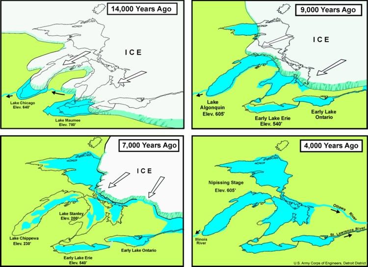
There are four main ridges that are preserved in the land from the old shorelines. Those ridges served as early trails for migrating people who moved into the territory as the land thawed. The footpaths of native people became the trails for pioneers. These paths then became the first roadways for wagons, horses, then cars.
As high ground, the ridges offered easy orientation and early observation of any potential encounter to natives and pioneers, who were wary of unexpected confrontations. The ridges also provided drier ground, since the land was the first to drain after rain or snow.
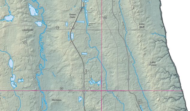
The ridges now support highways 294, 43 and parts of 41, and Green Bay Road/Highway 131.