Settlers Square Through the Years - A Bird's Eye View of West Lake Forest
Nature By Design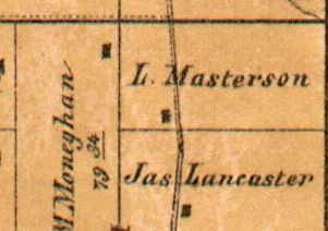
These maps and aerial photographs reveal the history of Lake Forest’s western business district from its earliest settlement to the 1994 dedication of Settlers Square. Waukegan/Telegraph Road bisects each image vertically; the Chicago, Milwaukee & St. Paul Railroad cuts through diagonally; and Everett Road goes through horizontally starting with the 1916 map.
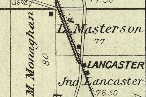
1861
James Lancaster and Lawrence Masterson were the first owners of the land along Waukegan Road, with Michael Moneghan to the west.
1885
In the 1870s, the Chicago, Milwaukee & St. Paul Railroad was built, and the Lancaster station established on the Lancaster family's property.
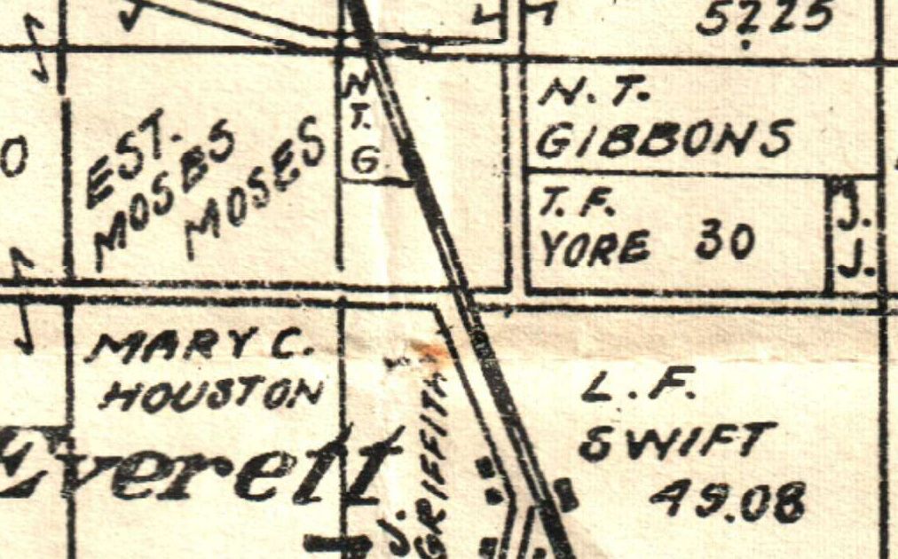
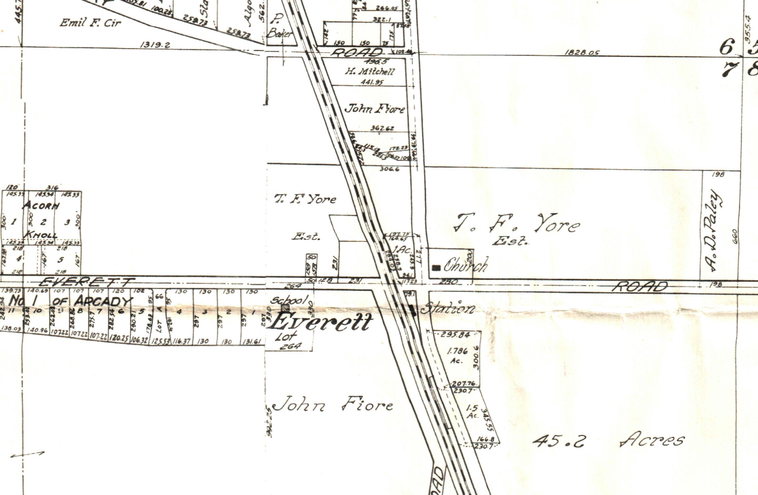
1916
By the 1910s, Everett Road had been constructed and the land had largely changed hands from the original pioneers.
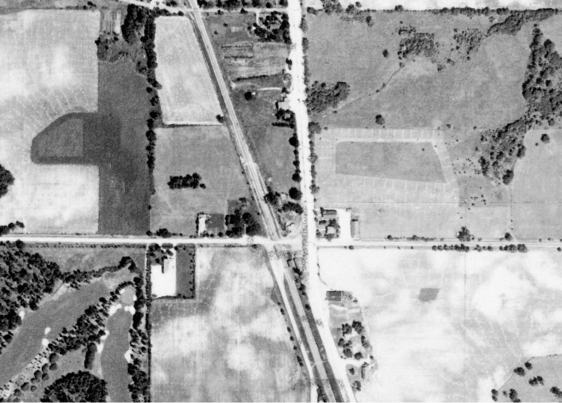
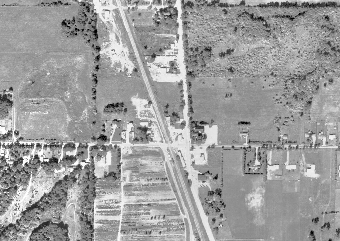
1939
This intersection was still largely surrounded by farmland in the 1930s. Take a look at the bottom left corner – you can see the edge of Albert Lasker's private golf course, bordered by Everett School and its fenced-in schoolyard.
1949
After World War II, change was on its way – as seen by the shrinking tracts on the map. At this point the train station was still located south of Everett.
1961
Notice the smaller lots and larger number of houses south of Everett Road. More commercial development along Waukegan Road is also visible. Despite these changes, open space still defines the area.
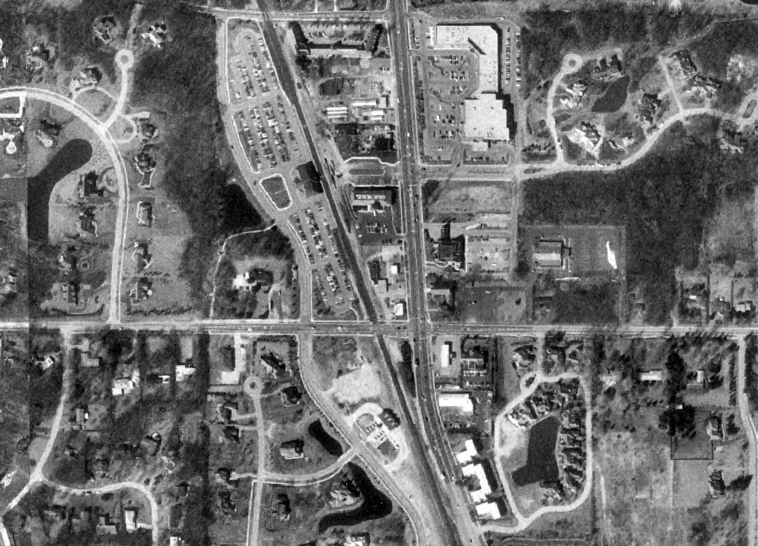
1993
Between the 1960s and 1990s, this intersection underwent a dramatic transformation. New roads and shopping centers have proliferated. The fire station moved east of Telegraph and the train station north of Everett.
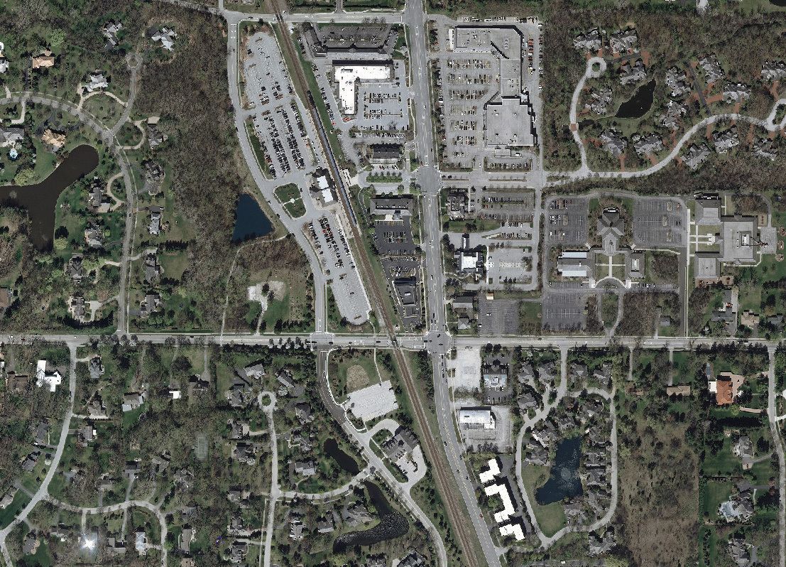
2012
Over the last 20 years, the shifts in the landscape are less striking, but the subdivisions have filled in with more homes, and Forest Square retail center has filled in the business district.